“String Theory,” Or How to Have More Fun Fishing Without Really Trying
Joshua Bergan photo
Our drive to go fishing rises from deep in our hunter-gatherer past. We’re scratching a primordial itch, like so many others that are disguised in modern life. For example, curiosity: an urge to pattern and order things, to know their names and to expand our understanding of the world. It’s an ancient genetic skill that made easier the passing of survival information to each next generation—what’s safe to eat, what will eat you, etc.
It’s so entrenched, now, that our modern mind needs to be reminded of the disorienting though obvious fact that all the things on the earth exist independently of our naming and classification. In Blood Meridian, Cormac McCarthy’s Judge Holden said that “…in this world more things exist without our knowledge than with it and the order in creation which you see is that which you have put there, like a string in a maze, so that you shall not lose your way.” Our minds are prisoners of language. How does a brook trout think about a beaver? Or a raven a chickadee?
Holden meant to insult humanity, but really, the winding of that string is one of our best achievements. We live much of our life lost, and we anglers go fishing to try to get un-lost. There’s even some literal string involved. We are relative experts on these wild animals, the fish, because we want to catch them, and with understanding, our appreciation for their nuance increases. The angler who wants to catch more fish (that is to say, all of us) can’t avoid casting that string about, expanding his or her understanding of fish and the places fish live, and it’s very easy to let this expansion bleed outside the water itself.
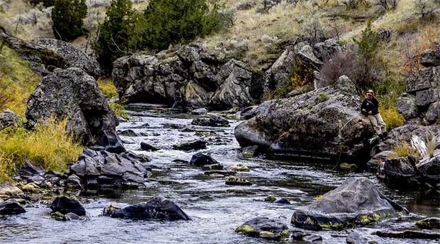
I say let it, if you believe fishing to be about more than rippin’ lips and Instagramming. Start with your home beat. There is so much more to learn and love about it.
I like to begin with maps. Study the topo maps (free from the USGS) and aerial imagery (Google and Bing) both before and after a trip, even of familiar home water. From your computer, you can get a completely new perspective on even an intimately known landscape. After one particularly grueling musky-fishing canoe trip a few years ago, I was analyzing aerial photos of the marshy riverbottom we’d just paddled into and back out of—a head wind, both ways—and noticed that on one map all the vegetation was late-fall grey-brown, meaning any green had to be spruce or pine, suggesting high ground. One green dot well into the interior proved, on the next year’s trip, to be a perfect sandy island just big enough to pitch a couple tents, saving us days of paddling back and forth to get to the good water.
Nature guidebooks are next. Birds, trees, and animal tracks; for the angler insects is an obvious one. You don’t have to carry them with you, but skimming (by region) is enough to pick up a periphery of knowledge that expands itself when you’re afield, especially if you hang a small pair of good binoculars around your neck. I recall a spectacular hatch of fluttering caddis one evening on the upper Jordan River in Michigan. The trout inexplicably never came to the table, but a group of cedar waxwings took full advantage, almost artificial in their beauty as they expertly navigated the tangled branches of their namesake trees, perching just long enough to chew and swallow the caddisflies. They might have been forgettable songbirds to me had I not seen a band of them eating desiccated highbush cranberries in northern Minnesota a few years earlier, been curious, and looked them up in Sibley’s that evening.
Historical perspective is another way to enrich your understanding of a place. Historic topographic maps are available free to download from the USGS, and are so fascinating to the landscape-curious and history-minded angler that they’ll make you feel better about paying your taxes next year. You’ll see the names of familiar rivers and lakes change over time, the addition and subtraction of roads and buildings, wetlands filled and creeks dammed or channelized. On one map I found the tiny square that marks a “structure” on what I knew as a brushy inside bend of a favorite trout stream on Lake Superior’s north shore. The next time I fished it, I spent ten minutes poking around and found a pile of steel barrel hoops, and the overgrown road that’d once led to the cabin—a much easier walk-in access point.
But whose cabin was it? Local human history—native people, timbering and mining, etc.—is most easily found in local small-press books, which can be found in tourist visitor centers, local libraries, and independent bookstores; if you want to really dive in, many communities have almanacs and collections of personal histories that you can read at the library. In fact, Michigan and many other states have keyword-searchable digital archives of such documents. Minnesota has digitized all of the original hand-drawn survey maps for free download. I found an 1892 survey of a chunk of what’s now the Superior National Forest that I know well. In his notes, the surveyor calls out one of my early-season secret bass spots as a “pretty little lake” in his ornate script, and right at the landing where I slide my canoe in every spring was a star and the note “Indian burial place.” Talk about adding extra flavor to a favorite spot; further research needed.
If we look a little further back—say, ten thousand years—geology can explain much about why a river does what it does. What’s its source? Runoff, glacial melt, or a sandy aquifer? My childhood home sits on the edge of the Canadian Shield, and the old hand-dug well was prone to running dry and being fouled by mice or other contaminants; later, when we had a replacement drilled, we had to go down 300 feet into the bedrock to get reliable, clean water. In contrast, a good friend’s cabin near the Manistee River in Michigan, sand and pine-stump country, has a hand-pump well in the kitchen that burbles cold, tasty water and is sunk only 15 feet down. While both properties are crossed by small trout streams, it’s no shock that his contains more brookies than mine. These kinds of conceptual land-science-histories can help as you explore maps for new watersheds. Knowing where the water comes from can tell you if, and even what, fish and insects might live in it.
Fair warning: there’s a downside to all this, too. Holden’s maze-strings do more than lead us into and back out of the world. They weave us into it, remind us of the billions of connections that must yet exist beyond our understanding, but that we happily sever in the name of jobs or progress or profit.
There’s a stream just south of the Twin Cities metro that has received thousands of dollars and many hours of restoration work to prop up a population of large but sparse brown trout. Lunker structures installed, stumps and trees anchored, gravel dumped in. For ten thousand years, this stream ran cold and clear and was home to native brook trout; a few generations of modern farming practices drained, poisoned, and channeled it far beyond recognition. Yes—it holds a few trophy brown trout. But the fun of walking its banks and even fishing it is rather spoiled by the knowledge of what it used to be.
Aldo Leopold put it just right: “One of the penalties of an ecological education is that one lives alone in a world of wounds. Much of the damage inflicted on land is quite invisible to laymen.” When you learn about the waters and landscapes you love, ecological threats begin losing their comfortable abstractness—and you may find yourself losing patience with the laymen.


